


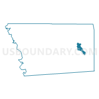
Magee 1 Voting District, Simpson County, Mississippi
About
Outline

Summary
| Unique Area Identifier | 606658 |
| Name | Magee 1 Voting District |
| County | Simpson County |
| State | Mississippi |
| Area (square miles) | 5.46 |
| Land Area (square miles) | 5.46 |
| Water Area (square miles) | 0.00 |
| % of Land Area | 100.00 |
| % of Water Area | 0.00 |
| Latitude of the Internal Point | 31.90915360 |
| Longtitude of the Internal Point | -89.74560230 |
Maps


Graphs
Select a template below for downloading or customizing gragh for Magee 1 Voting District, Simpson County, Mississippi


Neighbors
Neighoring Voting District (by Name) Neighboring Voting District on the Map
- Dry Creek Voting District, Simpson County, MS
- Magee 2 Voting District, Simpson County, MS
- Magee 2 A Voting District, Simpson County, MS
- Magee 4-N Voting District, Simpson County, MS
- Magee 4N A Voting District, Simpson County, MS
- Weathersby Voting District, Simpson County, MS
Top 10 Neighboring County Subdivision (by Population) Neighboring County Subdivision on the Map
- District 2, Simpson County, MS (6,111)
- District 4, Simpson County, MS (5,193)
- District 1, Simpson County, MS (5,156)
- District 3, Simpson County, MS (4,787)